Walk # 94 August 21, 2013 Thetis Lake Park from Highland Road trail
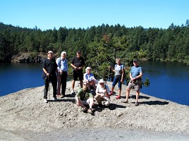
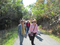
Di & John McMahen found this trail into Thetis lake Regional Park and agreed to lead this walk. We parked near the bus turn-around on Highland Road and walked into the park on the right hand trail, (looking from the road). The path slopes upward for quite a while and we took a prominent trail to the right that lead up into the tall trees. We kept taking the left hand fork until we finally came to a right hand trail that led us up to a little cement dam that was built across a narrow rock hollow that was filled with water. We followed the trail along the side of Bladder-wort Pond, and it eventually came out beside the lower lake. After a quick discussion we decided to see how long it would take to walk all the way around the lake. If time ran out we would turn back and cut the walk short. As it turned out we walked all the way around the lake and still made it back to the cars within the allotted time and got to the Four Mile Pub on time for our lunch reservation. Thanks to John and Di for showing us some new trails. This walk was 5.57 kilometers. To view Phil's photos and videos please click on the following link:
https://plus.google.com/photos/117826671765550615361/albums/5914691787449160849?partnerid=gplp0
To view Terry's photos and video please chick on the following link: https://plus.google.com/photos/108709526830847929475/albums/5914701588474880017?authkey=COyo0NHHtun8YA
https://plus.google.com/photos/117826671765550615361/albums/5914691787449160849?partnerid=gplp0
To view Terry's photos and video please chick on the following link: https://plus.google.com/photos/108709526830847929475/albums/5914701588474880017?authkey=COyo0NHHtun8YA
Walk # 95 August 28th, 2013 South End of Beaver Lake trails
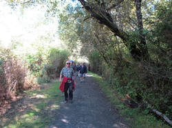
We parked and met at the big parking lot at the south end of Beaver Lake that is reached by taking Beaver lake Road from West Saanich Road. This parking area is situated on the filter beds of the old water pipeline that supplied Victoria with fresh water from Beaver lake. It was built from 1874 to 1876 and from the start the water quality was problematic from the start. A nine mile pipeline that was only 7 to 9 inches in diameter was laid from a dam at the end of the lake into downtown Victoria. Despite many projects to try and improve the quality and quantity of the water a better water supply was sought and a new pipeline from Sooke was started in 1915. The Sooke Lake reservoir was upgraded in 1970 to today's standards. Along the trail we came across a sign with a railroad spike and a section of the track from the old Victoria to Sidney railroad that used to run along the side of the lake. To see Terry's photos please click on this link:
https://plus.google.com/photos/108709526830847929475/albums/5917281045140443313?authkey=CMuIzMu3n42FCQ
https://plus.google.com/photos/108709526830847929475/albums/5917281045140443313?authkey=CMuIzMu3n42FCQ
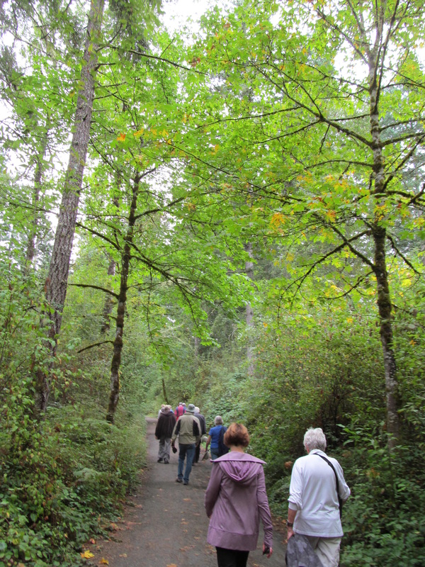
Walk #96 September 4th, 2013 Whitty's lagoon trails and beach
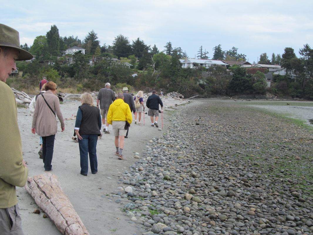
The group met at the parking lot near the nature house and at 11:am we started down the trail that leads to the beach. I'm glad that the trail wasn't too muddy as it could get rather slick after a lot of rain. We met a group of students from Pearson College at the beach and learned where they were all from. We proceeded along the beach to the left end of the beach where the inlet to the lagoon is. The water was still running out so that means that the tide was still going out. There was time to enjoy the scenery, talk to each other and explore the tidal pools before we headed back up the trail towards the cars. We took a side trip to the far viewing platform to see the Sitting lady Falls. Lois sang us one of her girl guide songs while Merv made bird calls. We headed back to the cars and went to the My Chosin Cafe for lunch. A group as large as ours could have trouble getting into that popular restaurant without reservations, but we only had about a 10 minute wait before we were seated. The food there is quite spectacular! To see Terry's photos please click on the following link: https://plus.google.com/photos/108709526830847929475/albums/5919907734434631633?authkey=CKqu9v3MkJHDhAE To see Phil's photos and videos please click on this link:https://plus.google.com/photos/117826671765550615361/albums/5919900670755361713?partnerid=gplp0&authkey=CJD0-IPQ5OveAg
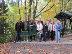
Walk # 97 September 11 2013 John Dean Park trails
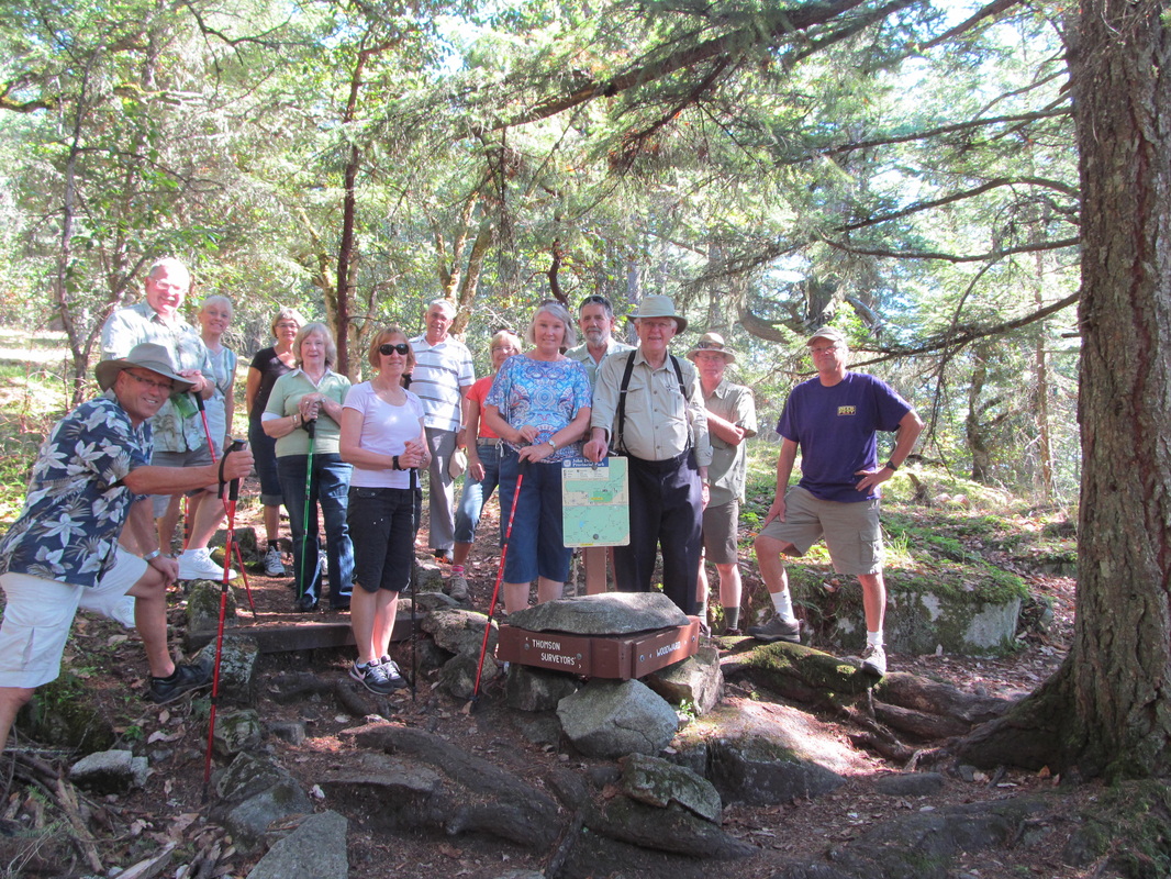
John Dean Park has a lot of trails. It could be easy to get lost in this park. I waited until I had a better map of the trails to suggest a walk/hike in this forest park. It was a beautiful summer-like day when we walked out to Emerald Pond along the Illahee Trail. Keeping to the left hand trail at every junction we crossed the dam at the end of the pond and made our way around in a clockwise loop. See the map that is attached with the photos. We joined the Woodward Thompson Cabin Trail that led us up a long flight of stairs, and a long uphill climb to the radar dome that is shaped like a giant soccer ball on a metal stand. We believe that this radar is for the Victoria International Airport. Nearby was the marine radar installation that watches the south coast marine traffic. We were now on the service road to the reservoir for the Dean Park Estates and the Central Saanich area. The service road took us back to our cars. Near the end of it we took the Thunderbird trail that comes out at the same place. This was a 2.76 kilometer or 1.71 mile hike. It took about 75 minutes. We went to the Prairie Inn for a lovely lunch that was very reasonable in price. To view Terry's photos and one video please click on the following link. https://plus.google.com/photos/108709526830847929475/albums/5922485629525514769?authkey=CKmQqu--z9jSRw
Walk #98 September 18th 2013 Galloping Goose Trail part 7
The walking group met at the trail on Lombard Drive just off of Rocky Point road where we were going to continue our walk along this historic railway bed. This is probably the longest walk that the group has ever done. The total number of kilometers walked was 9.47. Some of us had tender hips and knees after we got back to our starting point. An RCMP presence seemed to hint that they were watching for an inmate from the William Head Penitentiary who had recently walked away. The weather was perfect, and the lunch at the My Chosin Restaurant afterwards was excellent as always. To view the photos and videos that Phil took please click on the following link: https://plus.google.com/photos/117826671765550615361/albums/5925097059534909857
To view the photos that Terry took please click on this link: https://plus.google.com/photos/108709526830847929475/albums/5925093909305025489?authkey=CMbGq4mm5MrSFA
To view the photos that Terry took please click on this link: https://plus.google.com/photos/108709526830847929475/albums/5925093909305025489?authkey=CMbGq4mm5MrSFA
Walk # 99 September 25th 2013 Beaver Lake Trails (East Side)
On September 25th the walking group met at the main parking lot of Beaver lake and walked along the lakeside trail as far as the Rowing Centre buildings and beach at Eagle Beach. At that point we made a group decision to turn back and go back along several different trails to the beaver lake parking area where we started. Di McMahen took over the lead and showed us around lots of trails and along a pretty little stream. We eventually got back to the start in time to get in the cars and head off to the Fireside Grill for a nice lunch.
To view Phil's photos please click on the following link: https://plus.google.com/photos/117826671765550615361/albums/5927690436643906001?utm_source=feedblitz&utm_medium=FeedBlitzEmail&utm_content=279500&utm_campaign=0&partnerid=gplp0
To view Terry's photos please click in this link: https://plus.google.com/photos/108709526830847929475/albums/5927691276403020225?authkey=CNjisKfJ8-_vrAE
Walk # 100 October 2nd 2013 The Westsong Walkway in Esquimalt
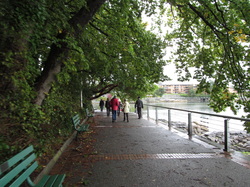
On October 2nd 2013 the CAMRAmblers braved a stormy sky and met near the end of Dunsmuir Road at Head Street near the end of the Westsong Walkway and walked all the way to near the Johnson Street Bridge and back. This is nearly 4 miles round trip. The rain held off and the sun actually tried to come out for a while. We walked back to the Princess Mary Cafe that was started by the owner of the original Princess Mary Restaurant. We enjoyed fast service and good food even though the beer and ale selection wasn't as good as we had expected. To view Terry's photos please click on the following link:
https://plus.google.com/photos/108709526830847929475/albums/5930283378809690209?authkey=CJaGpeeLs53L2wE
To view Phil's photos and videos please click on the following link:
https://plus.google.com/photos/117826671765550615361/albums/5930276259608014865
https://plus.google.com/photos/108709526830847929475/albums/5930283378809690209?authkey=CJaGpeeLs53L2wE
To view Phil's photos and videos please click on the following link:
https://plus.google.com/photos/117826671765550615361/albums/5930276259608014865
Walk # 101 October 9th 2013 Galloping Goose Trail - Matheson Lake part
On October 9th the CAMRAmblers met at the Galloping Goose Trail parking area near Matheson Lake and met up with Di and Peter who had parked at the other end of this section of the trail at Roche Cove. They brought their bikes and rode the trail to where we were gathering, locked their bikes and walked the trail with us. It was another lovely day. The trees are starting to change colour and the mushrooms are starting to come out everywhere. The 5.5 kilometer walk took us only 70 minutes. Then we loaded into the vans of Peter and Di and got shuttled back to the starting point where we picked up our vehicles and headed off to the My Chosin Restaurant for lunch. A group as big as ours had to wait about 15 minutes to be seated, but the great food made up for it. Anther lovely day with great friends.
To see Terry's photos and video please click on the following link: https://plus.google.com/photos/108709526830847929475/albums/5932895242485625041?authkey=CNGRo-bWqtnLswE
To see Terry's photos and video please click on the following link: https://plus.google.com/photos/108709526830847929475/albums/5932895242485625041?authkey=CNGRo-bWqtnLswE
Walk # 102 October 17th, 2013 A Chinatown History Walking Tour
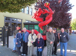
On October 17th the CAMRAmblers met at the entrance to Market Square and walked through the square learning about the history of the tenement apartments that once occupied the buildings that surround the square. We then crossed Pandora Ave, and entered Fan Tan Alley and walked through to Fisgard Street, We had to detour through a store because part of the alley was closed for repairs. We crossed Fisgard and entered Dragon Alley stopping to look at the many small shops in there. Exiting on Herald Street we looked at the biggest building in Chinatown, then walked up to the Chinese Temple. Around the corner we stopped for a group photo at the murals that show what the shops once were like, before heading up to the Chinese Public School. We ended the walk at the Gate Of Harmonious Interest, and walked back the Guild Pub where we had reservations for lunch.
To View Terry's photos click on the following link. : https://plus.google.com/photos/108709526830847929475/albums/5935852488263076961?authkey=CIiEwa72tPDKjQE
To view Phil's photos click on this link: https://plus.google.com/photos/117826671765550615361/albums/5935860009506404321
To view Laura's photos click on this link: https://plus.google.com/photos/109567001728485403565/albums/5935939814506056849?authkey=CK_zzLinxcOiqgE
