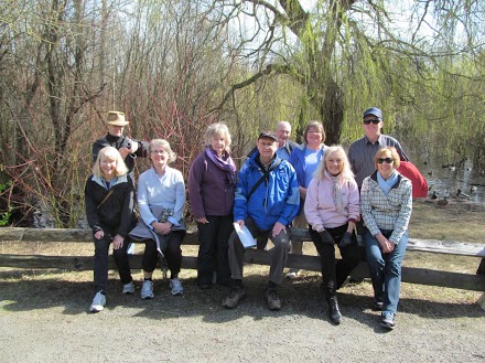
Walk # 69 February 27th 2013 Markham Road to Camosun College and back
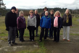
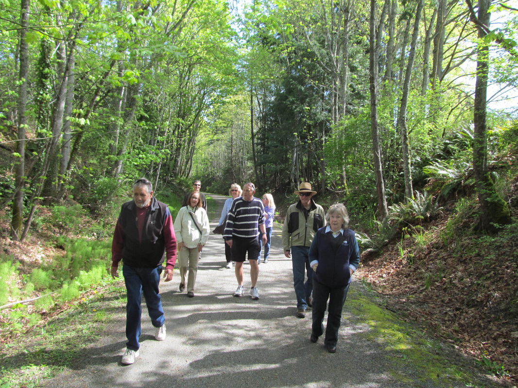
We had a good walk today, along Markham Rd to Layritz ball park, behind Pacific Sports Excellence, along to Camosun Interurban Campus, along Layritz Trail to the lake and back, then back to the cars. Many thanks to Barry and Jill for allowing us to park there. Interesting use of the soccer field, teaching fly fishing. There would have been more pictures but the camera button on the iPad was uncooperative. We started with cool, crisp weather but stayed to the prepared trails because of the recent rains. Lunch at the Crooked Goose Bistro, very good.
To view Phil's photos please click on this link: https://plus.google.com/photos/117826671765550615361/albums/5849772290852246897?authkey=CL70idOxwYzjeQ
Walk #70 March 6th 2013 Hyacinth Park to Swan Creek Park and back
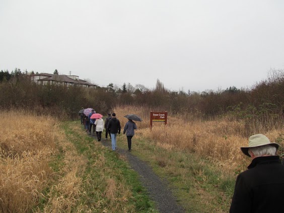
On this misty/rainy day we met at the Hyacinth park on Marigold Road where there is ample parking. A short walk towards Interurban road takes you to a part of the Colquitz creek trail, and the branch trail that follows Swan Creek. We walked along the Swan Creek park trail crossing residential streets and going under McKenzie road until we came to the intersection of McKenzie and Cary road where we used the pedestrian overpass to safely cross that busy street. We headed up past the Marigold elementary school to Margaret st. where we turned right to go towards Glanford Ave., where we crossed into another section of the trail. We soon came back to McKenzie Ave again and had to walk up the frontage road to Glanford again to cross at the crosswalk. Once across we turned back to find the trail that leads back into the creek for the last part of the trail. At Kent road the trail ended at the allotment gardens and that's where we turned around. After a detour to the nearby 7Eleven for a pit stop we headed back the way we had come.
To view the photos that Terry took click on thus link https://plus.google.com/photos/108709526830847929475/albums/5852373945277110993?authkey=CIK5pJ_K15zATA
To view the photos that Terry took click on thus link https://plus.google.com/photos/108709526830847929475/albums/5852373945277110993?authkey=CIK5pJ_K15zATA
Walk # 71 March 13th 2013 E&N Rail Trail in Esquimalt
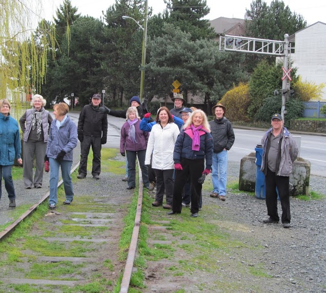
We needed a trail that was mostly paved due to the large amounts of rain that fell this week. The E&N Rail Trail, although not officially opened seemed like the thing to do. We started near Spinnakers Brewpub and walked all the way to Admirals Road. Most of the trail seems finished, but there were signs stating the the public should not use the trail. We ignored the signs and didn't see any progress on the trail being made. The out and back only took us about 95 minutes, at a good walking pace. We drove over to the Moon Under Water Brewpub for a nice lunch afterwards.
To view Terry's photos click on this link:
https://plus.google.com/photos/108709526830847929475/albums/5854960756513291761?authkey=CLzWu_jniZ6cjQE
To view Phil's photos click on this link
https://plus.google.com/photos/117826671765550615361/albums/5854973191811412417?authkey=CPPH1N3_pu-igQE
To view Terry's photos click on this link:
https://plus.google.com/photos/108709526830847929475/albums/5854960756513291761?authkey=CLzWu_jniZ6cjQE
To view Phil's photos click on this link
https://plus.google.com/photos/117826671765550615361/albums/5854973191811412417?authkey=CPPH1N3_pu-igQE
Walk # 72 March 20th 2013 Lochside to Cordova Ridge walk
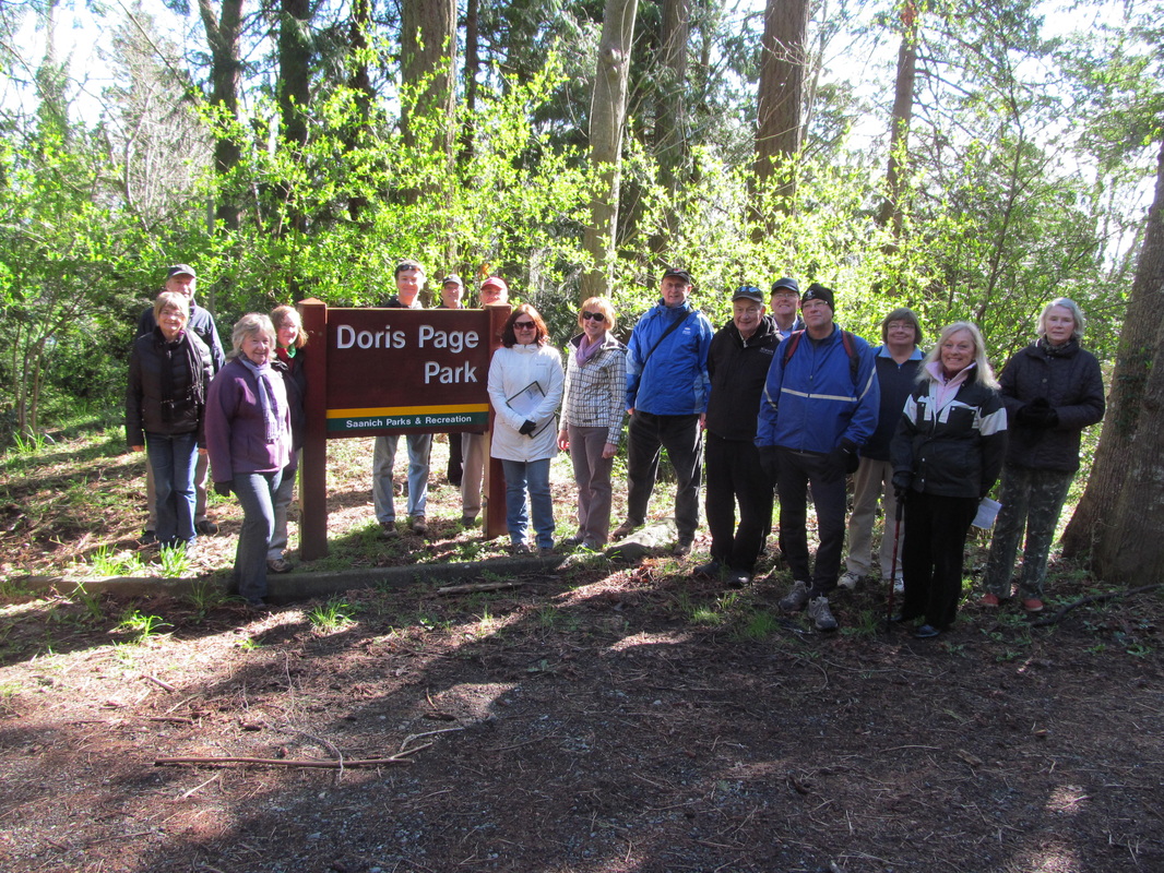
This walk involved parking near McMinn Park on Lochside Drive and walking north to Doris Page Park where we learned about this Cordova Bay pioneer and her English garden. She left her property to the municipality and although the house is now gone there is still evidence of her garden to be seen, along with the tremendous view of the sea from the picnic table area. We continued along Lochside to a short cul-de-sac on the left that leads to Doumac Park. A nice trail leads through the park and keeping to the main trail we eventually came to a large wooden stairway leading up to Piedmont Gardens. We turned left at Del Monte Ave., and walked south to Haliburton Rd where we made a short jog to the left and entered Haliburton Pl. Then we turned left onto Cotton Crescent and looked for a trail that passed between two houses and lead to Westbury Crescent. A short way up this road we came to another trail beside a hedge that lead to Wesley Court. We walked down to The corner of Wesley Rd., and turned right and walked up a trail and through a gate that leads to the large cement reservoir. . The first trail that leads steeply down to the left is the correct one that leads through Grant Park and crosses four streets before it comes back out on Lochside near where we parked the cars at McMinn park. We went to the Beach House Bistro for lunch. To view Terry's photos click on this link: https://plus.google.com/photos/108709526830847929475/albums/5857638060841993857?authkey=CKCn0K3S6qbiMw
Walk # 73 March 27th 2013 Gordon Head Rec to Bow Park and return.
We met at the Gordon Head Recreation centre and walked over to Shelbourne. Crossed over to Feltham and walked up across Cedar Hill and into the first of the trails at the end of Feltham. We eventually came to Bow park and found lots of ducks pairing up there. We started to go around the lake via a trail off Tyne Court but found that it did go through as marked on the maps. We had to circle back around the lake the way we came and then headed down another path that took up out to McKenzie Ave. near the pedestrian overpass. We walked east about a block and found a path that leads over to Arrow road. A few blocks along Arrow road we went into a narrow lane that took us over to Hopesmore Dr. We followed this street until we came to Orelton Place and found the last path that took us back to the main trail again. We walked back across Cedar Hill Road and Shelbourne and up Feltham to the rec centre and the end of the walk. Only a few people went to the Maude Hunter's Pub for lunch. This walk took about 90 minutes and was just under 4 miles.
To view the photos that Phil took please click on this link: https://plus.google.com/photos/117826671765550615361/albums/5860169253195659425?authkey=CMOf--zs0bWnpAE
To view the photos that Terry took click on this link https://plus.google.com/photos/108709526830847929475/albums/5860149240315166737?authkey=CPy3hvT1hK-HkgE
Walk # 74 April 3rd 2013 E&N Rail from View Royal to Trans Canada Highway
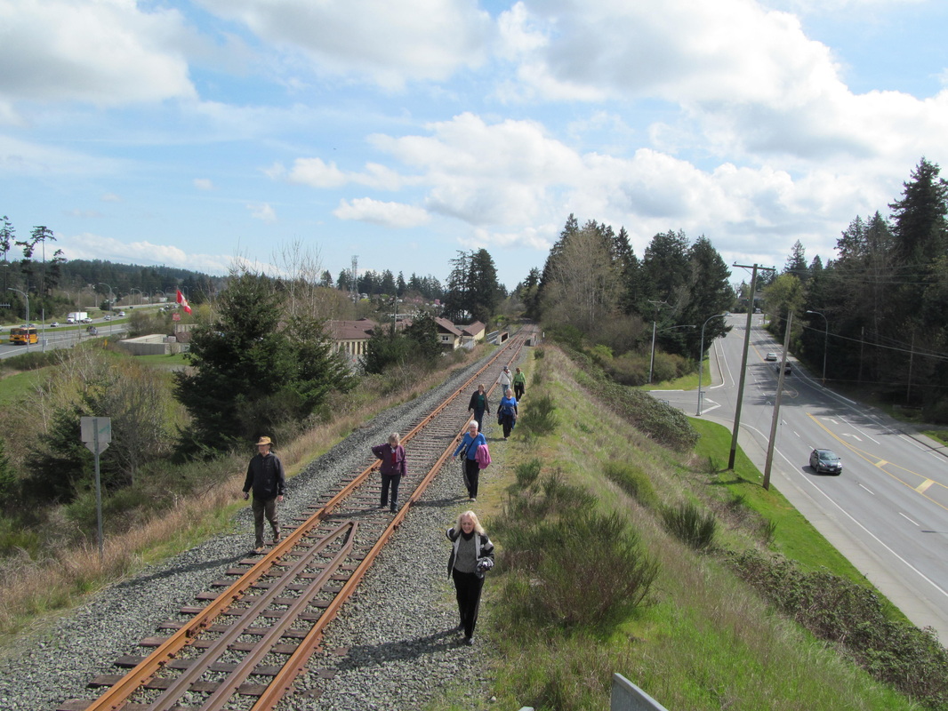
The weather is finally getting better, and as we walked the temperature got warmer and the sun came out, The Rail Trail is not built yet but we walked along the tracks all the way from View Royal to the Trans Canada Highway. There are views of the portage Inlet that you can't see from any roads along this walk. We had to avoid a small part of the construction by detouring through Portage Park. The total distance walked was 3.97 miles. or 6.40 kilometers. As this is a rail bed walk there was no elevation, in other words..no hills. As always we had a nice lunch at the 4 Mile Pub after the walk.
To view Terry's photos click on the link below.
https://plus.google.com/photos/108709526830847929475/albums/5862745472715503793?authkey=CJ76oY_n8OTTdA
To view Phil's photos and videos click on this link.
https://plus.google.com/photos/117826671765550615361/albums/5862766505946185649?authkey=CPSSwuySuu3bZQ
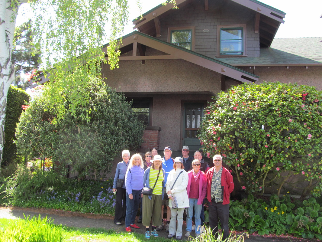
Walk #75 April 10th 2013 Esquimalt Historical Homes Walk
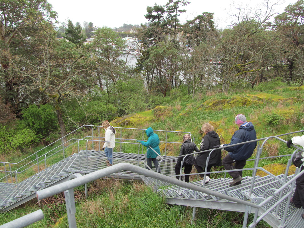
This was perhaps the coldest and windiest walk the group has ever been on. The object of this walk was to find some of Esquimalt's historic homes, and to explore some of the interesting natural places as well. We started off by finding a old home on Dunsmuir Road and then walked to the end of Garrett place where a path leads around the huge condo development and provides views of the Garry Oak Meadows and the huge metal staircase that took us down to the Westsong Walkway. Descending this staircase we walked along the Westsong until we came to Head Street and then we followed the marked route (see map) to try and find the marked houses. One of the most interesting homes seems to be missing, and a vacant lot was found where it should have been. We walked back to our starting place and found that we had missed two houses on Wollaston Street so we walked down to see those interesting homes before heading off for lunch at Spinnakers Brewpub.
To view Terry's photos please click on this link:
https://plus.google.com/photos/108709526830847929475/albums/5865359273528851201?authkey=CK3_quLpiuWYXA
To View Phil's photos please click on this link;
https://plus.google.com/photos/117826671765550615361/albums/5865347510983211105?authkey=CK6izqSa8_Pm9wE
Walk # 76 April 17th 2013 The Langford Parkway Trail and beyond
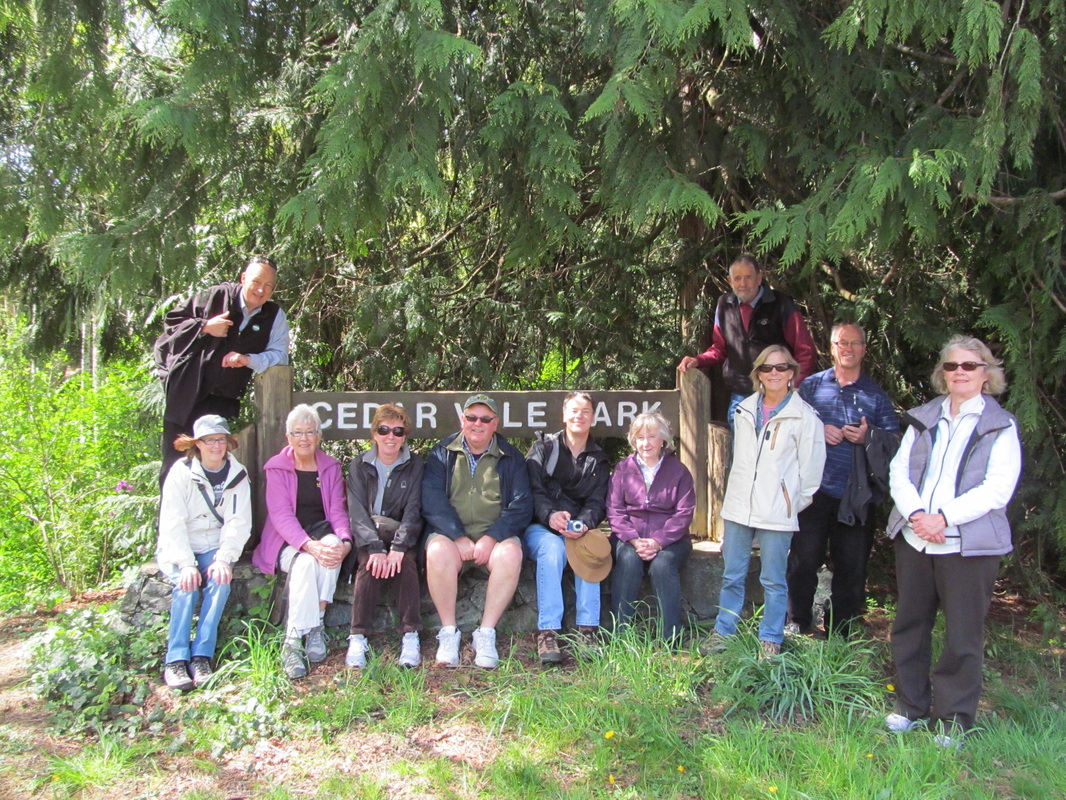
Exploring new trails with good friends is fun! This is a trail that I found on the Langford website. It's finished length is only about 1.5 kilometers but there is a rough trail that goes on and on towards the Mill Hill park trail called the Calypso Trail. We walked for maybe another half kilometer before we turned back. Then we explored the Cedar Vale Trail. There were lots of wildflowers and beautiful big trees. The Millstream River flows under the Trans Canada Highway and into this area. The Mill Hill Regional Park is only a short distance away. The total length of this walk was 3.5 km or 2.17 miles. To view Terry's photos click on this link: https://plus.google.com/photos/108709526830847929475/albums/5867949700372061601?authkey=CLbNoOva1YzdLA
To view Phil's photos and video please click on this link: https://plus.google.com/photos/117826671765550615361/albums/5867940854988853521?authkey=CLm2_4qUr4jaYA
To view Phil's photos and video please click on this link: https://plus.google.com/photos/117826671765550615361/albums/5867940854988853521?authkey=CLm2_4qUr4jaYA
Walk #77 April 24th 2013 The Galloping Goose trail part two
Finally we have some warm spring weather! We have already walked one section of the Galloping Goose Trail (see walk # 23 on February 8th 2012) Today we have come to the starting point where we will walk the next section of this old railway bed trail. Parking at the Juan De Fuca arena where we have 4 hour parking we met at the beginning of the trail on Sooke Road near the now closed White Spot Restaurant. We kept up a decent pace for the whole walk, only the first part had a slight up hill incline. The whole walk, out and back took only 90 minutes. This walk was 4 miles or 6.5 km. We went to the 6 Mile Pub but found it very busy so we went to the 4 mile pub and had a nice lunch. To view Terry's photos please click on this link:
https://plus.google.com/photos/108709526830847929475/albums/5870562480445751473?authkey=CK-j76qF74mHcg
To view Phil's video and photos please click on this link: https://plus.google.com/photos/117826671765550615361/albums/5870541708360378353?authkey=CPP6iLmO3NC7Iw
https://plus.google.com/photos/108709526830847929475/albums/5870562480445751473?authkey=CK-j76qF74mHcg
To view Phil's video and photos please click on this link: https://plus.google.com/photos/117826671765550615361/albums/5870541708360378353?authkey=CPP6iLmO3NC7Iw
Walk #78 May 1st 2013 North Park Heritage Homes walk
We met at the corner of Vancouver and Pembroke streets. Just outside of Royal Athletic park and across the street from Central Park. We followed a route that took us up and down Vancouver Street, Princess Ave., Cook Street, Queens Ave., and Empress Ave. We crossed Quadra and walked a block of Wark Street, Bay Street and Dowler before coming back to Central park via Princess Ave. This area has many fine heritage homes dating from 1907 to 1933.
After the walk we returned to our cars and headed to the Fernwood Inn for a refreshing lunch and some Bottle Rocket ISA. To see the photos please click on the following links: For Terry's photos click on this link: https://plus.google.com/photos/108709526830847929475/albums/5873151404686757297?authkey=CNvWoIGV2-mioAE
For Phil's photos click on this link: https://plus.google.com/photos/117826671765550615361/albums/5873141636781706225?authkey=CKvvxLnV99-9_gE
Walk # 79 May 8th 2013 Dallas Road from Beacon Hill Park to Ogden Point
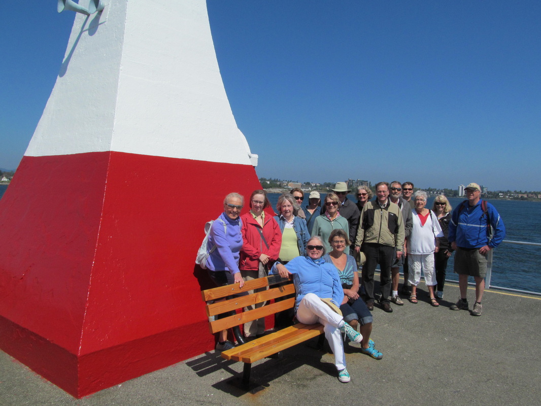
We met at the side of Dallas Road just beneath the hill and flag pole on Beacon Hill. At just after 11:am the large group of us, (17 persons this time) started our walk to the Ogden Point Breakwater to see the new handrails that have recently been installed. Do you know that Ogden Point was named after Peter Skene Ogden, a Hudson's Bay Company man in 1843. The 800 m breakwater was completer in 1916. The wind off the water was brisk and cool, but everyone was prepared and we enjoyed the walk out to the end of the breakwater and back, and the walk back to our cars. The whole 5.7 km walk took less than 90 minutes. We headed to the Beagle Pub on Cook street for lunch. Here's a link to the history of the breakwater: http://www.ogdenpoint.org/history_of_opes.html
To view Terry's photos click on the following link: https://plus.google.com/photos/108709526830847929475/albums/5875731660010910609?authkey=CLSUnKqria-GlQE
To view Phil's photos and videos click on the following link: https://plus.google.com/photos/117826671765550615361/albums/5875784686027704033?authkey=CNyo_e6nxOPwqAE
